
Second Star gear guide
Road Trip Essentials
Road-trip packing list
Road-trip gear
Phone mounts, chargers, coolers, emergency supplies, and small car organizers for the drive to and from the destination.

Car Phone Mounts
$25.6
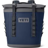
Road Trip Coolers
$275
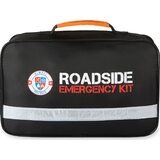
Car Emergency Kits
$49.99
Open road-trip guideMore picks on SSG →


